Saturday, 30 January 2016

Wilmot Wander 32m 2016

I had a place in this run round Derby in 2015. It is held on a Sunday and on the Friday I had to cancel because of an incident at work. I emailed the organiser to let him know as participants were leaving in pairs in two minute intervals and I thought it would be useful for him to know I wouldn't be starting.

I hadn't expected any response, but two weeks later a letter arrived and enclosed was a cheque refunding my entry fee ! I was astonished, that had never happened before and it left me with a feeling that I would enter the event again and so I entered for 2016 in the autumn of 2015. They were taking entries on the day so I could have left it until closer to the event. Melanie had some training to do so I would be going down to do this on my own.

I have been given a map with the route on but it hadn't copied particularly well. I found a plan of a route on the web that looked pretty good and I downloaded that to my phone and Garmin, so I was hoping that with those three aids I should be able to get round. I wasn't expecting the route to be marked.

The forecast didn't look great, light rain on the walk over from the hotel and then heavy rain by the time I started. This was forecast to last for four hours before returning to light rain until my estimated finish time. After that it would clear up !

I checked in about 40 minutes before my start time and picked up what looked a better copy of the map and a written route description. I bumped into Simon, a 100 marathon club member I have seen at many events and later Paul, someone I had got to know via the fetcheveryone website. I started with them and Paul had done this route several times and it was useful to hang on to them and get through the first tricky bit of navigation. After that it soon became clear that I couldn't keep up (I had been struggling to chat to them and run) so off they went. We were now in pleasant undulating countryside and we soon entered what is or used to be a private estate, complete with lake and stately home.


Overall it was a fairly scenic route.

The course was unmarked (apart from one short 100 meter section which had three signs , a bit random) and you had to keep your wits about you not to make a mistake, there were lots of twists and turns and choices to make. I didn't do this to a standard I was happy with. In total I made three errors, but luckily none of them were serious. After about 8.5 miles, I knew I had to make a left turn but I made it too early. The path I had taken seemed to be going the wrong way so I headed across a field in what I thought was the correct direction. The runners behind me also took this path and called me back and said they thought the path I had originally chosen was the correct way. I followed them for about 100 meters and then I was convinced this wasn't right. Also walkers in the event behind us were looking at their maps, always a sign that something wasn't right. I called back the two runners I had been following and we went went back along the field to get back to the right path. They apologised for calling me back but the error was mine, I had turned left too early.

The second error was emerging from a field and turning right on to a road soon after 14 miles. There was a spectator there (one of very, very few, the heavy rain had arrived a few miles earlier). I should have turned left off the road almost immediately, but in my head I was at a different place on the map and I continued along the road. After about 100 meters I knew I was wrong from the bread crumb line I was following on my Garmin (the line wasn't there anymore, big clue !), but I didn't know what I had done wrong. Luckily the spectator was driving by in her car and she stopped and told me exactly what path I should have taken. That saved me considerable time, but I was still a bit disappointed with myself. I had had some difficulty with changing map pages in the rain and they hadn't gone in the map case properly so where I was on the map wasn't visible. If I had taken a bit longer to get the map case sorted when changing pages this probably would not have happened.

About a mile later I came to a new housing estate being built. Clearly the path which used to be straight on had gone. Do I go left or right ? Paths, both ways. I chose left and then spotted a hole in the fence. If I followed that line through the estate I would be running parallel to the original path. Fine in theory but my line ended up in a cul-de-sac so I had to backtrack and go further along. Slightly frustrating but I didn't lose much time here. Overall I have calculated I covered an extra 0.75 miles with my errors which wasn't to bad, it could have been a lot worse.

The rain finally stopped after 20 miles and the rest of the day was warmer. This was a relief, I had been starting to get a little cold. I also had been struggling with what felt like a crease in my sock which was making it a bit painful to run. I stopped a couple of times to try and take my shoe off to sort the problem but my hands were too cold to undo my laces which were also covered in mud. I had to resort to just trying to pull up my socks but that seemed to only help for a short time.

I have briefly mentioned the mud so far, but it formed a lasting part of my experience at this event. There was lots of it and it was often very slippery and boggy. Lots of people fell over and I almost went when running downhill. Early on I cursed not bringing waterproof socks, but my feet soon got used to getting wet regularly. It was particularly bad when approaching a stile or a gate and there were quite a few of those. One runner I spoke to afterwards who had done the event over fifteen times said it was the worst underfoot conditions he could remember.


One hairy bit was crossing the A38 at 21.5 miles. At this point the A38 is dual carriageway, traffic flying by at 70 mph + and crash barriers in the central reservation to clamber over.

I was stuck in the central reservation for longer than I was comfortable with.

My training for this event had been poor. It had been six weeks since my last marathon (and I had walked a fair amount of that one) and no more than one 10 mile run since. Not good enough, so I knew I would run out of steam at some point. But that point was 24 miles which wasn't too bad.

At that point I had just reached the canal.


Following a canal towpath for 3 miles sounds fine, but the towpath has a bit of muddy nightmare, very hard to run on, I was slipping everywhere and I just had so little energy left in my legs.


It was a relief to get to the checkpoint at the end of that section. I asked how far the finish I was told that it was 5 miles and that it was all flat on tarmac bicycle paths. That should have sounded like bliss, no more mud ! But there was nothing left in my legs and I only seemed to be able to run a few yards at a time. Power walking seemed fine so I resorted to that and made reasonable time back to the finish.

There was soup, bread, cake and biscuits awaiting in the Scout Hut at the finish.. The five checkpoints on that way round had had squash, water, hot drinks and biscuits, so I had had enough biscuits. The soup, bread and cheese were just lovely. There was a certificate to all finishers. Most of the entrants appeared to be fairly local and I only came across one person who had not done the event before which shows that those who have done it once like to do it again. Too soon for me to say whether I would do it again.

I made my way back to my hotel and treated myself


The route (corrected to remove my errors) is on Fetcheveryone

Monday, 14 December 2015

Hardmoors Roseberry Topping marathon 2015

The day before this event, Saturday, it started to snow in the North East. The forecast was for a hard frost overnight, so it looked this was going to be a challenging run. It had been 29.3m last year and Jon had added a bit more on so we were almost going to Blowarth Crossing before leaving the Cleveland Way. At least there was very little wind this year and it was sunny for most of the first half.

Melanie was doing the half marathon and as I was getting up at 5.00 for an 8.00 start, we decided to take separate cars so that she could have a bit of extra time in bed and she wouldn't have to hang around for me at the finish.

At the pre-race briefing Jon said that there would be safety diversion on the first descent from Roseberry Topping. We would be going down the same way as we went up the second time, that is going down the steps on the north side. I don't think it made very much difference to the distance covered.

We set off soon after 8.00 and after a short section along the bottom of Guisborough Woods we started the muddy  and snowy ascent up to Highcliffe Nab.


On reaching that we had a fantastic view of cloud inversions to the south. These inversions were there all day, it was amazing.


We crossed to Roseberry Topping which looked amazing in this weather.


The descent down Little Roseberry and up Roseberry Topping wasn't too bad although the rocky steps were just a little slippy. The descent down the north side was more slippy on the steps, but that way down at least there was some grass either side which you could use. I took it very easy. It became very muddy towards the bottom. When we finally reached the checkpoint, we turned around and made our way back up again the same way and then down the west side. Whilst going down and up other runners were very encouraging and we were encouraging them, one of the things that makes trail running so enjoyable.

As I was climbing back up Little Roseberry, Melanie was coming down a path about twenty yards from mine and we managed to shout a few words to each other and she snapped this picture of me (look closely !).


I carried on to Gribdale and then it was the climb up to James Cook monument.


It was just beautiful weather, cold but much less slippy now. We came to the 'Striders' checkpoint where the routes separated and it was lovely to see Anna, Denise and Phil.


Down to Kildale and up the other side following the Cleveland Way to Tidy Brown Hill (this was the additional section). Finally at Burton Howe, not far from Blowarth Crossing, we made the turn back to last year's route. This section was fine underfoot, but one we got to Skinner Howe Cross Road that all changed. This was part of the Eskdale Eureka route which we had been run last weekend and it was a proper fell running path, wet, rocky, uneven, partly covered in heather and muddy. Far too technical for me to run given I was running out of energy at this stage (about 18m). On to the very familar Esk Valley Path that Melanie and I walked last Easter and this was muddy as well. On to tarmac at Castleside and the undulating track to Commondale.

Then the final mainly uphill 5m (with another 1.5m or so of very technical path) to Guisborough Woods which never seem to be getting closer, before the final muddy descent through the woods to the finish. I just made it back before dark.

I was very tired when I got back and quite shivery. I got changed and headed home as soon as I could. Melanie really enjoyed her 15m run


Saturday, 7 November 2015

Hardmoors Goathland marathon 2015

Melanie wasn't well enough to do the half marathon, so I set off for the marathon (close to 28m) on my own. The weather forecast wasn't good, heavy rain until 1.00. That seemed a challenge and I was quite excited about the event.

The route was the same as the one Melanie and I did last year and having run the Crosses and the Saltergate Circuit in this area in the summer I was pretty certain I would be able to find my way. This was lucky as I managed to leave my Garmin with the downloaded route at home. I have just subscribed to OS maps and I had the route on my phone in their app as a backup, but I didn't need to look at it. The route was also very well marked and marshalled. The marshalls did a fantastic job often huddled in tents in the weather we experienced.


I got to Goathland pretty early and just before I arrived the heavens opened and I did wonder what I was doing. This was very heavy rain. At the car park it is just heavy rain so I made my way to the Village Hall checked in and collected my number. I chatted to the Quakers group, who are ever presents at these events, until the briefing. At the briefing I met up with the five other Striders doing the marathon (Jules, Mandy, Debs, Diane and Sue). Another four did the half marathon, so it was a good turn out from the club with Flip marshalling as well. Thanks to Mandy for the picture

Just before the start, I took off my waterproof trousers as the rain didn't seem to heavy. I started reasonably and soon found myself running with my clubmates Diane and Debs. We ran together until about 19m when Debs went on ahead and Diane and I finished together.

The first part of the route takes us past the Mallyn Spout waterfall and this involves navigating over some slippery rocks. Not everybody had seen the waterfall and there were some audible gasps at how lovely it looked. We then climbed onto the moors and rain changed from light to heavy. I tried to see if the stepping stones (on the half route) were flooded when the two routes split, but they were too far away to see.

We had the trudge up to Simon Howe and then south into the wind (but downhill into the forest). Then down to the Pickering Grosmont railway and a steam train went by which was good to see. We climbed out of the valley. Underfoot was muddy but about what I expected. At the top of the but underneath Saltergate I knew we were about half a mile from the next checkpoint but one at the Hole of Horcum car park. However we had to go south for about 3m and then climb up to Levisham Moor and go up for another 3m to reach the Hole of Horcum car park.

Those 3m south gave us some lovely views but the wind was strong and in our faces so we ended up run walking this runnable section. We climbed up the hill to the next checkpoint and started on our way across the moor. This was when we had ten minutes of the heaviest rain I think I have ever been out in. Some people said it was hail where they were there. It was deafening as it hit our waterproofs. At this point I wished I had my waterproof trousers on, but it was way too late to stop. Finally it passed and it started to stop altogether. And then to our amazement the sun came out for about half an hour. It was lovely and we could see for miles as the steam evaporated from the forests in the distances (thanks to Debs for the photo).

We made our way to the checkpoint and on to the Old Wife's Way and came across Flip who was giving out chocolates and making sure all the runners went down into the valley before heading towards Flylingdales. Once we got past Malo Cross it was very muddy. We had a respite for a while after Flylingdales then after Lilla Cross it became very bad, wet, boggy, slippery, paths nothing more streams. I had my waterproof socks on again and they were great. Diane fell in this section but she wasn't hurt.

We came to the stream crossing of Little Ella Beck before the Ella Beck checkpoint and we could see the Quaker group ahead of us were working their way upstream trying to find a place to cross, so Diane and I went even further upstream and found a place where we could get across.

Down to the checkpoint, across the road and the railway line and then a trudge up to Simon Howe again and then the final turn south back to Goathland.

As we came off the moor Flip, Camilla, Anita and Joan were waiting for us and they cheered us in. That was lovely and we passed Jan before we got back and she was equally encouraging.

Got back to the Village Hall sometime after 4.00 I think. I didn't really care about the time. There was loads to eat and I had soup, crumpets and various cakes. Thanks to Mandy for the pictures


I had expected this to be a bit of an adventure and it certainly was. I wish I had had a bit more energy in my legs, but it has been a tiring week with my Dad being ill. If Melanie hadn't been recovering from illness and been able to look after my father I wouldn't have been able to do this one, so many thanks to her 😀


Monday, 19 October 2015

Spires and Steeples 26m 2015

I had been looking for a marathon for October and this is an event I had not done before. It sounded very low key and a very much like a LDWA type of event. The event started at 9.30 in Lincoln and we followed the Spires and Steeples path most of the way down to Sleaford. It was an event for walkers and runners (the walkers on the 26m route started an hour before the runners and the runners and the walkers on the 13m route started together at 11.00)

Melanie had some academic work to do so she opted to stay at home whilst I travelled down to Sleaford the day before and stayed in the local Travelodge. I had a bit of time to find the car park where the coach would take us to Lincoln and where the finish would be. I also looked at the last half mile of the event and the signs were already out. It looked like it might be very well signed.


The coach to Lincoln left Sleaford at 8.00 and I met up with Gary and came across Adrian and we chatted away for a while. We arrived in Lincoln for the start near the Castle with plenty of time to spare. I had a chat with with Jim, another 100 marathon club runner I have met at various events.

We started soon after 9.30 and made our way down to the river through the quiet streets of Lincoln. This was definitely a net downhill event as we started off relatively high and after that there were no hills at all, just very gently rolling countryside and small villages.

The event was a little different in a few ways to most events of this type. Firstly we were given six wristbands, we left one at each of the five checkpoints and at the end.

There was also no results, though there was a certificate, medal and small goody bag. The organisers said there would be a clock at the end to record your time, I didn't notice it, but I am used to recording my own time anyway. The other unusual feature was that the checkpoints, with the exception of one which had cereal bars, had no food. There was also no food at the end, apart from the local Rotary serving soup for a donation. I didn't mind any of these, I was carrying my own food and there was plenty of shops open in the villages and in Sleaford if I had run short.

The route was superbly marked and also marshalled in many places. A few runners carried on along the road instead of turning off on a footpath in the first village, Washingborough, but luckily someone who had done the event before shouted most of them back. I made one mistake at about 20m, there were runners and walkers ahead of me and I just put my head down and followed them, but within 100m I realised that I hadn't expected to go this way. On with the glasses and I checked on my watch where I had downloaded the route, checked my OS map on my phone and both devices said I was definitely off route. I had expected to be going right at this point and there was a path in that direction, should I take that one ?? Or maybe the people ahead had followed the route description and I hadn't plotted it correctly ?? Uncertain about what to do, I glanced back and saw some other walkers and runners waving me back, so I went back there and realised I had completely missed a sign down another path. By the time I had done all this faffing, the people who had been in front of me were far away and there was no hope of shouting them back. I ran by those who had waved me back and thanked them and let the next two sets of marshalls know.

After leaving Lincoln we ran along an old railway line and then had a brief diversion on to slightly muddy track and into Washingborough. After that it was a succession of paths across or around fields, slippery footbridges, small villages, churches, canal towpaths and some sections of quiet roads.


Overall I was pleased to have chosen trail shoes for the event, but there was quite a bit of tarmac and pavement. The last 4m was on the towpath of an old, largely abandoned, canal which was a nice way to finish.

I was happy with my time of 4hr 47min, it was probably the flatest trail marathon I have ever done. I did miss the hills, which I would normally walk up. I am just not used to running continuously for 26m - I didn't, I took walking breaks up some very gentle inclines !


Sunday, 20 September 2015

Hardmoors 60 2015

I have come to love the Cleveland Way. My initial reaction after running along it a few times was that it was designed for walkers, not runners. Lots of steps, some of them very uneven, stone slabs which can be slippery in wet conditions and lots and lots of hills. However, after now doing many Hardmoors events, the Osmotherley Phoenix and other events I do love it. The view are gorgeous and the sense of satisfaction you get for running on the Trail  is hard to beat. The trail goes from Helmsley to Saltburn on the coast and then goes follows the coast to Filey.

I had run the first half, the Hardmoors 55 in 2010 in pretty awful conditions. I had always wanted to do the second half and when the organiser, Jon Steele, put on the Hardmoors 60 I was very tempted. However, I wasn't confident of hitting the cut offs. This year the cut offs were extended and I thought I could make them.

Preparation included the Crosses, which didn't go particularly well and lots of climbs up Wainwright hills in August. I think both helped, particularly the hill walking.


The plan was that Melanie would support as she made the Crosses so much easier, but a day before the event she came down with a bad cold. So I used drop bags and Denise offered to take a change of clothes to Ravenscar for me. That worked very well as the temperature changed dramatically after Ravenscar as the day changed from very hot to very cold.

Kath, a clubmate, and I had agreed to run together. We and three clubmates had run together at the Hardmoors Princess 31m two weeks ago and we had also spent some time running with Sara. So Kath, Sara and I ran together in this event and it worked out very well. Sara had not run further than 36m and she did fantastically well finishing this event.

It was 62m in total and it was said to be over 10,000 feet of ascent. I had set up the followmee tracker app on my phone which seemed to have little effect on my phone battery when the update rate was set to 15 minutes. However, at some point during the race I managed to switch on my flashlight. How I did this I don't know and it has happened before. The result was that my phone died in Whitby, which was a shame as Melanie was using the tracker to see where I was. Luckily Flip and one or two others were able to post updates on Facebook and send texts.

I am dividing the race into three stages, each of approximately 20 miles, as this was how I framed the route in my mind.

Stage 1 Guisborough to Runswick Bay

I felt I knew this pretty well. We started slowly and after the first stile I was last for a short while. The climb up to High Cliff Nab was muddier than I expected, but better than on the Hardmoors Roseberry Topping marathon last December. The view down on Guisborough was beautiful:


Some of this section I had covered several times, but there were sections I had only covered once. I was also unfamiliar with the location of the Saltburn checkpoint.


However, the race description helped us to find this easily. I was also a little unsure of one part of the Skinningrove diversion. However, Flip, Anna, Jon and Shirley were there to make sure we took the right turn.


Skinningrove to Boulby I had done once before. There was many more hills than I remembered. At the top of them was my daughter and her husband with some very welcome supplies. It had developed into a hot day with little wind and we were drinking lots and lots of water.

Boulby to Runswick Bay goes through the beautiful Staithes. It looked lovely in the beautiful weather. The next section was also one I had only done once a few years ago. Again there were more hills than I expected. It was very hot and although it looked like we were going to get through our informal cut offs that I had calculated for lots of places, we didn't have a lot to spare and I was finding the heat and hills very hard going. It did cross my mind to pull out at Runswick Bay, but we had about 30 minutes to spare at that point so I decided to just see how it went. Looking back I think I was just going through a bad patch which is just inevitable in a long event. There were others who were wilting in the heat and eleven runners withdrew at this checkpoint. In total there were 163 finishers and 32 runners who withdrew.


Stage 2 Runswick Bay to Ravenscar

I thought this would be by far the toughest section especially the very familiar Whitby to Ravenscar section.

Runswick Bay was as lovely as ever and the climb out wasn't as bad as I expected it to be. I was rusty with the route to Sandsend, but it wasn't too bad. We were taking it pretty easy, walking all the ascents and gently running the rest. We made to Whitby where I came across Angela and John who were having a weekend away. At this point my phone was losing charge because of the flashlight, so I had a conversation with Melanie to explain before the charge slipped away. At the top of the steps Kath and I had an ice cream.

We kept on seeing the lovely Quaker support team who were supporting their runners who were just behind us for most of the way. Sara's partner Oliver and son Robin (eighteen months !) also popped up in lots of places and Flip also seemed to be everywhere. It is hard to explain what a difference this makes, but it certainly encourages me.


The Whitby to Robin Hood's Bay took us an hour and fifty minutes, about ten minutes faster than I expected. Flip was in charge of the checkpoint. The next section is only about four miles, but I have never done it in less than an hour. There are lots of climbs and descents. The descents aren't ones you can run down with carefree abandon and expect to live. They are steep, large steps and there are some rock steps which can be uneven and irregular.

We went into Ravenscar more tired than we had been two weeks ago. The heat and the extra ten miles had taken their toll. We spent 35 minutes at Ravenscar. I changed everything apart from running shoes - Scott Kinabalu Supertrack - I still think these suit me very well. I also had rice pudding and coffee and consumed some of my food from the drop bag.

Stage 3 Ravenscar to Filey

I had expected this to be much easier than the other two sections. I found it as hard as the two other sections.

We came out of the Ravenscar checkpoint and it was very dark and although I was now wearing a long sleeved top, it became clear that I was cold and shivering. I put on fleece top and that stayed on until the finish. It is amazing what a change of clothes and food can do, we ran most of the way to Hayburn Wyke again familiar territory. I had hoped that Hayburn to Scalby Mills would be straightforward. It wasn't, it was much longer and more up and down than I had expected. I also made a minor navigational error, but that probably only cost us 3 minutes. Scarborough never seemed to arrive. We were walking more than running. When we arrived at the north end of Scarborough we were in danger of not making the cut off at the south end which was three miles of flat concrete away. We missed it by about four minutes but they seemed happy to let us continue. More coffee and flapjack.

We set off again and we walked almost all of the next section. I was a bit rusty on the Cayton Bay to Filey section but I had saved my Garmin for Stage 3 and I had the route on there and this helped enormously otherwise we might have been tempted to follow the group ahead who made two errors and seemed very uncertain of which way to go. We ended up finishing with them although they had run much more of this section than we had. It was lovely to see Flip waiting for us at 2.00 am on Filey Brigg signalling us with his torch :-)

We were 22 minutes late into the finish, but nobody seemed to mind and there were others who came in soon after.


Thanks to Flip for the lift back to my car 😀

Would I do it again ? When I was doing it, I didn't think so, it was too tough to be enjoyable and the roller coaster of emotions you get on such events I find hard to cope with. But now only fourteen hours after I have finished I find myself thinking it was very scenic, the organisation was first class and the marshalls were just fantastic. I am wondering what I will think in a few days !

Sunday, 6 September 2015

Hardmoors Princess 31m 2015

It has been two months since the Crosses. There have been no marathons since then and my longest run in August was 11m. The plan was to do the Tour of Fife (five short races in five days), followed by the Hardmoors Saltburn and then the Hardmoors Princess leading up to the daunting Hardmoors 60.

The Tour of Fife went fine, but a week later I had problems with my ankle. It may have been caused by running too hard and fast in Fife (something I am not used to). But it meant that I could not do the Hardmoors Salthburn which was disappointing.

We did some hill walking in the Lakes last week and during that time my ankle got better and and better, but I had a temporary back problem at the beginning of last week and I was just hoping it would fix itself for the Hardmoors Princess.

It did :-) I drove down with Kath, Debbie and Nicola from the Striders and I ran with them and Angela (another Strider). Kath is an experienced long distance runner but the other three hadn't done more than a marathon before and they all had great runs on a tough course !


The weather was cloudy and very windy. It also started to rain heavily just before the start so it was looking a bit grim. The rain stopped before the start, but I had my waterproof top and gloves on to keep warm.


The waterproof came off at about 2m, but the gloves stayed on until Robin Hood's Bay the second time when we had some shelter.

I carried some poles to try them out on the first 8m (when we reached the start again). We ran most of that so I didn't really get the chance to try them very much so I left them when we got back to Ravenscar. This was my sixth time running this route, so navigation wasn't a problem.

We set off down the Cinder Track on the lovely descent to Robin Hood's Bay. However this section has a history of injuries and it happened again as Nicola took a tumble. My first aid kit came in handy and we reached Robin Hood's Bay.


We walked a lot of the climb out of Robin Hood's Bay, the wind was in our faces and it was a bit of a slog. The rain came when we reached the top but it didn't last too long and we made it to Whitby and the lovely sign over the Bridge at the checkpoint.


We then dodged the tourists in Whitby, smelling fish and chips everywhere and climbed the steps to the Abbey and headed onto the Cleveland Way. Now the wind was behind us and blowing us along. Shorlty before Robin Hood's Bay again , we reached the 26.3m point which was the furthest that these three had every ran :-)


As we came into  the Robin Hood's Bay, there was a Striders support party, which was wonderful :-) Thanks to Kelly and her family, David, Neil and Elaine :-)


The last 4m are tough, very hilly, lots of steps. But we were sheltered by the headland so we didn't feel so battered, it was almost warm !

There were some Striders waiting for us as we approached the finish


There was loads of food at the end, chips, pizza, cake. Flip and Kelly did a great job of organising this excellent event.

It was great to have company on the race and to have support from the Striders. I have also now done over 500 Hardmoors miles 😀

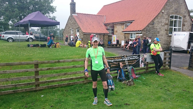
Thanks to Debbie, David, Kelly, Neil and the Scarborough and Ryedale Mountain Rescue (the event was held to support this team) for some of the photos.

Saturday, 4 July 2015

The Crosses 53m 2015


This section is written three days before event starts  ...

I am a bit nervous about this event. It is five years since I ran an event over 50m or 40m or even 35m. I normally do marathons, though some of them like the Hardmoors marathons are often closer to 30m. I always get some nervous anticipation before a race, especially a marathon, because I know it is going to be hard at some point. I know I will question why I am doing that event. But I know that feeling won't last and the buzz I get when I am finished is always good. I wonder if I didn't get any nervous anticipation whether I would do the events. Maybe if it was all routine, then that is the time to find something else to do.

I nearly didn't enter this event, but I read that it is a one off event in aid of the Scarborough and Ryedale Mountain Rescue Team. So if I didn't do it this year I might never get another chance. The plan is that the route visits many of the crosses on the North York moors. It starts at midday in Goathland so I will be finishing in the dark also at Goathland. One good thing about it is that I have covered some of the route before in the Hardmoors Rosedale, Smuggler's Trod, Rosedale Ultra and Hardmoors Goathland races. But there is the nagging negative voice which says are you getting a bit too old for 50m+ events ?

My positive voice says well that is exactly what you said in 2006 before you entered your first marathon. That and all the following ones worked out well, so why not this one ??

After the event ...

With a midday start we could have a bit of a lie in. We drove down in two cars as my car would go in the event car park and Melanie would drive round and support me. This worked out great, it made it so much easier being able to change my shirt (twice) and shoes (once) and pick up food. Thank you Melanie :-)

On the drive down it was cloudy and at one or two places on the moors, there was thick fog. It was still pretty hot, but there was a bit of a breeze. It could have been been much worse there have been some very hot blue skies days with no wind this last week.

At Goathland we parked up and went over to the Village Hall, registered, collected the goody bag and chatted to the many Hardmoors runners who were there. There were quite a few walkers doing the event - there was a 24hr cut off so there was plenty of time to walk round.


From the start at the Village Hall we started off running down the old railway track just like on the Hardmoors Goathand event, but we went a bit further before turning west and heading to our first hill.


After this were small sections of road and lots of paths across the moors. Some of these were uneven and I realised that my Hoka Stinsons were not the best to start this event with, I was twisting my ankle a bit too much. After the first checkpoint at about 6m there was a steep descent into Glaisdale where I had to slow down to keep myself from slipping over. The second major climb, on road (Caper Hill at about 9m), got us out of Glaisdale and there was Melanie waiting for me at the top. By this time the sun was out, but luckily there was a breeze. It was in our faces, but it did give us some relief from the sun.


After the second self clip at Botton Cross, I managed to lose my tally card. It was pretty windy there and I had to bend right down to get it scanned so maybe it fell out of its holder then. Luckily I remembered my number which kept the checkpoint staff happy.

I met up with Melanie at the Lion Inn and had more water melon, it was so cooling :-) Then it was the long stretch on the old railway line to Rosedale Chimney. This stretch I know well and it seems to go on for a long time. I was walking and running by this time. There are some beautiful views down to Rosedale.

After reaching the Chimney checkpoint it was a lovely downhill to Lastingham where I met up with Melanie.


After this there was a long stretch of road followed by a long drag upwards on a forest road before a plunge down to the Pickering railway line at Newtondale Halt. This was followed a very steep climb out of the dale before the drag up to Saltersgate. Here I met with Melanie for the last time and changed shoes and finished off the water melon.

After the next checkpoint, Lilla Cross, it was on with the new head torch, the Alpkit Arc. It had come with batteries but they didn't last much more than an hour so I had to try the big selling point of the Arc, the easy battery swap. I managed to drop the replacement case, but luckily I had a second headtorch and was able to find it !

The next section was Robin Hood's Bay Road, which was the furthest from a road that you could imagine. I would have struggled to run much of this if I was fresh and and it was daylight.

This section was very well lit with perfectly placed glowsticks. After Postgate Cross, (where I stopped for some lovely soup :-)) the glowsticks got a bit more sparse and I had at tricky time getting to John Cross. Luckily I knew where I should be from the Smuggler's Trod and got myself back on track. From there it was a bit of plod back to Goathland which I reached at 9 minutes past 2 am. There was a certificate and a nice commemorative buff for finishers.


Having done the first half in about five and half hours, I can see that I am marathon fit, but not really able to go too much beyond that. I should have done more back to back runs to get myself used to running on tired legs. The heat in the first half also took its toll.

I am pleased I did it, but I am not sure I would do it again if it does happen again in the future, it was last done in 1999 and cancelled because of low numbers and only brought back this year because it is the 50th anniversary of the Scarborough and Ryedale Mountain Rescue Team. Apparently they had 250 enter this time (they had a 300 limit) so it is possible it might continue as a fundraiser for the Team who did a great job at the checkpoints and at the finish in Goathland.