
In 2015 it went the other way and it was heavy rain in the first half, but turned out to be a lovely second half. Here is Diane and I approaching Saltergate (this year's Saltergate photo is further down)

The forecast on the Thursday before this year's event was (click to see the detail)

So it looked like it was going to be very, very wet and windy. However, the forecast kept on improving, but it still had heavy rain and drizzle for the time I would be out there. As I parked the car in Goathland and walked over to the Village Hall there was a bit of rain, but not heavy. However, the wind was quite strong so I had waterproof top and bottoms on to keep warm.
The Village Hall was lovely and warm and I chatted to Garth and other people I knew. At the race briefing Jon threw in that there was going to be four and half hour cut off at Saltergate at 15m. So that was my target, get there in that time and I should be fine to finish in the overall cut off of 9hr. I didn't think I would take anywhere near that long as I had finished in a bit over 7hr last year, but you can never be certain that you won't injure yourself and have to slow down.
Outside at the start, the rain had now become light drizzle and the wind had dropped a little. I decided to keep on the full waterproofs as I felt that once on the moors the waterproofs would help keep me warm and that worked out well.
The route was advertised to be the same as it had been for the last two years, so I had no anxieties about finding my way. To be sure, I had the route on my watch and maps downloaded to my phone.
I stayed at the back at the start

as I wanted to take my time over the rocks at Mallyan Spout

and not feel any pressure to go too fast. At this point the drizzle had stopped so my hat came off and remained off for the rest of the race. I kept the thin gloves on though.
After this there was a long pull up onto the moors

The visibility was quite good at this point. After the first checkpoint, we climbed up to Simon Howe and the mist got thicker. On the way up, with Jason, Paul and Dee, some other runners were coming across at 90 degrees towards us, quite how they had gone wrong I couldn't figure out. By Simon Howe I had left the others and started south towards Wardle Rigg.
The mist here was quite thick and at one point I had to think exactly where I was. With no landmarks in sight it felt disorientating and for a short while I thought I was going west from Simon Howe. I quickly pulled myself together and remembered I was going south, checked my watch for the route and carried on.
Approaching the Wardle Rigg checkpoint we came across the very waterlogged section of the course. There was no alternative but to wade through some of it. I always wear waterproof socks for this event and they worked just as well as they have done before.
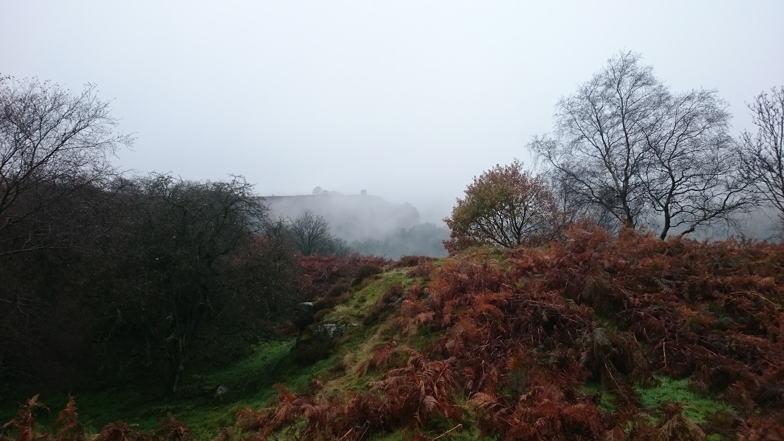
The descent to the railway line and the pull up to just below Saltergate were fine. The colours in the woods in the valley were lovely

In the previous two events this has always been a low point as I know that the Saltergate checkpoint is only half a mile away,

but we have to go all the way

along to Levisham Bottoms, climb up to another checkpoint outside Levisham and do a drag up Levisham Moor to reach the Saltergate checkpoint (probably about 5m in distance).
This year I didn't feel this low point, I just got on with it. The run along Levisham Bottoms was lovely, you could look across the misty valley.

As I climbed up to Checkpoint 4, near Levisham, we entered thick cloud with visibility down to about 50 meters. I got to where Checkpoint 4 was supposed to be and there were just two people standing there. I asked whether they wanted my number and they said no they were just spectators. This threw me a little and then Jon, the race director, appeared out of the mist and said I needed to go down to Dundale pond, up the hill to where the checkpoint was because the checkpoint wasn't in the right place.
This didn't make any sense to me, how did they get the checkpoint to be on the way to Saltergate, I couldn't remember any road access on that section. Oh well, off I went down to the pond where there was marshall who took my number and then said I needed to go back up another hill but not north to Saltergate, but in a roughly southerly direction back to Levisham but up another track which leads to a road end and that was where the checkpoint was. The marshall said I would then be coming back to him, so I imagined we were doing an out and back section to fit the checkpoint in. It wasn't quite like that, we did the other two sides of a triangle (you can see the triangle on the second map above) to come back to the marshall at the pond. As I came back back Jon shouted out that he had managed to lengthen the route and add more ascent ! I asked the marshall at the Pond whether this had confused the lead runners and apparently it had. I guess if you don't find a checkpoint you just carry on along the route, you don't go looking for it.
At this point I could see two other runners gently jogging up the hill and disappearing into the mist. I decided just to walk this gentle ascent, I felt tired and there was still a long way to go. I knew that I would make the four and half hour cut off at Saltergate which would probably be extended anyway because of the Checkpoint 4 confusion. It is a shame there were no views from here as the mist was so thick.
I made it to Saltergate in four hours. The road was busy there and visibility was probably less than 50 meters but the crossing was well marshalled. Thanks to Matthew Nelson for these two photos


I caught up with the other two runners who were just ahead of me, but again they started running as I continued walking up any ascent I came across. Again I caught them at the turn off the Old Wife's Way and again they ran on into the mist.
I came up to Malo Cross

which looked in danger of falling over. Then over the boggy section to Fylingdales and on to hard track. Again I nearly caught up with the two runners who looked unsure of the way, but once they saw me approaching they felt reassured and ran on into the mist and out of sight.
Again they were only just ahead of me at Lilla Cross. Rod, the marshall there, warned me that the beck at the bottom which we had to cross was in full spate, so I knew that would be fun. I went down the muddy path from the cross carefully and my two front runners vanished again into the mist. After the muddy path end the route goes along a well surface track before turning off onto the moor. The turn was well taped, but it came up suddenly (there is no permanent sign or I didn't see it) and I wasn't expecting it to be quite where it was. I trudged down this very boggy section crossing multiple small streams. This was part of the Lyke Wake route that I had done in July (but in the other direction). It was wet then, but it it was much worse yesterday.
Jon had taped the crossing of the beck, but it looked like you had to wade so I ignored that and went to where I normally cross (I heard later that people who crossed there had water way above their knees) and got across without getting wet.
Down and out of the mist and I couldn't see my two front runners anywhere. I thought they had either made very good progress on this boggy section or possibly they had missed the turn on the moor (it turned out to be the latter as they finished after me).
Now the clouds had lifted, it was turning into a lovely evening. I got to the last checkpoint at Ellerbeck where I was directed across the road and not over the bridge, so I was jumping across the stream again ! Then down into the valley and across the railway line again and up to Simon Howe where the two marshalls were in good spirits despite being out on a hill top all day. Photo taken by Mark Dalton

Then it was the lovely descent back to Goathland and the Village Hall. Back in 7hr 3min which was better than in 2015, but not as good as 2014 when I ran it with Melanie.
A hard but a lovely day out on an attractive route.
Part of me wished that the route had included the stepping stones at Wheeldale which were on the half marathon route. The stepping stones looked like this on the Lyke Wake

Here are a couple of pictures from yesterday (photos by Valerie Kidd)

