Monday, 13 February 2017

Hardmoors Saltburn marathon 2017

I was running this one with Sara


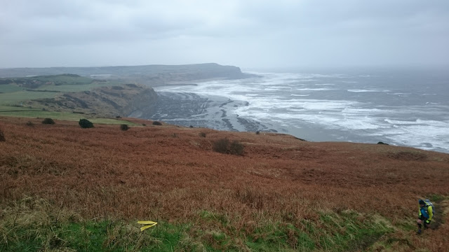
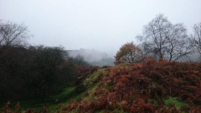
(this photograph was taken on the cliff tops between Saltburn and Skinningrove, not long after the start).

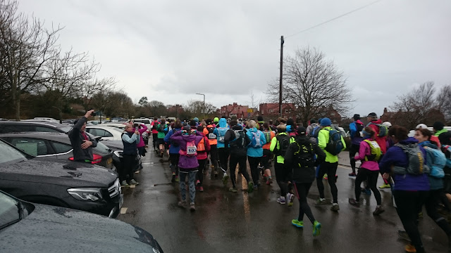
"Enjoy and don't die" were the final words at the race briefing from Jon Steele, the race director. Good words on a day when the weather forecast was awful.


The winds were forecast to be very strong and they certainly were. The route follows the coastal cliff tops for a while before heading inland towards Guisborough Woods. Then it is up onto the moors before heading back to Saltburn.

The start through Valley Gardens, which is well sheltered, was fine and not as muddy as I expected. Once we hit the coast and had climbed up the cliffs it was very different. 


Here there was occasional heavy sleet/rain showers, but it was the wind which seemed to be largely in our faces that made it tough.


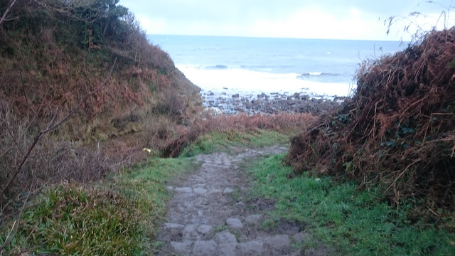
The steps down to the beach at Skinningrove was amazing I felt like I was being blown back up again.


Then there was the inevitable climb out of Skinningrove.


We ran along the cliff tops a bit longer than last year (to avoid part of the Cleveland Way that goes through someone's garden) and there were some great views


I had hoped that with the wind behind us and moving away from the coast the next section, back through Skinningrove, past Brotton and North Skelton and on to Skelton Green would be easier. It was for a while, but the fields were muddy and at some point the rain became relentless. At Skelton Green, 12m, the half marathoners, turned for home (though they still had 3m to go ;-)).

After that we were back on the Cleveland Way to Slapewath and both Sara and I noticed that the weather turned distinctly colder. The rain also turned to sleet then snow at times. Down to Slapewath via very muddy steps and back up into Guisborough Woods where the snow was beginning to lie.


We descended down again to the bottom of the woods and ran towards the bottom of the climb to High Cliff Nab. One of the marshalls there asked if we were cold. I said I was fine, but I hadn't quite appreciated what was to come soon.

The climb up to High Cliff Nab was the muddiest I have ever seen and it was great to see the two encouraging marshalls cheering us on from the top


All the marshalls did an awesome job, at least us runners were moving but they had to just stand there in awful weather.

We continued on, mainly upwards through the woods on muddy and increasingly boggy trails. Finally we emerged on the moor which I had expected to be a bit boggy. It was worse than I expected and the wind and the snow and the hailstones were in our faces. It was a bit grim at this stage. We also seemed to be on the moors for much longer than I remembered. I wished I had put on another layer at this point, but the thought of stopping and taking it out of my bag and taking things off in that wind, well it wasn't going to happen. It was a big relief to get to the A171 and get off the moors. After that there was still plenty of mud and wind, but we were more sheltered.

It was only when I got into the Hall at the finish that I realised how cold I was. I sat down and found I couldn't undo my gaiters. Luckily Lorna could see I was struggling and came over to give me a hand. I got into the shower as soon as I could and that really helped.

I am struggling to remember a long event which I have run where the weather was worse than this. Would I do it again ? Yesterday, I would have said no, but today, well I am thinking about it .....

Sunday, 1 January 2017

Hardmoors 30m 2017

2016 had been a good year for running for me - 18 marathons/ultras and no injuries. It can't get much better than that. In January 2016 I decided that I would set myself a target to keep my motivation up. Normally, I react against targets, I prefer to just enjoy myself, but it was just me setting this one so I have enjoyed planning and working towards it.

The aim was to have completed 150 marathons/ultras within ten years of my first marathon in May 2007. But I was only going to do events which took my fancy and pace it steadily. It has worked, I enjoyed all eighteen events last year, which leaves me 6 more to do, so the Hardmoors 30 would the first of the 6 and would be number 145.

I have done the Hardmoors 30 three times and the Hardmoors Princess four times - the Princess is the same route, but run in the summer. I haven't done the Hardmoors 30 since the start moved to Robin Hood's Bay, so although I would be running over the same ground, it would be starting further round the route and a large part would be running the route in the opposite direction to what I was used to.

I was up at 5.30, left home at 6.30 and arrived in Robin Hood's Bay at 8.00. I had my kit checked, collected my number, had a cup of coffee, sorted myself out and chatted to a few people before the race briefing. Then it was outside and ready for the start.


As you can see it was cloudy and at this point there was little wind. The route started on the cinder track and there is a 3m gentle climb up to Hawkser before a lovely descent into Whitby. On the old route, this climb is usually at about 15m so I usually walk most of it. As it was the start, I ran it for the first time. As we went along the route, we were more exposed to the wind, so out came the waterproof top to put over two long sleeve layers. Every 30min or so it would rain briefly and a couple of times it was hailstones, but it was dry apart from that. It was a bit harder running into the wind, but once on the descent it was fine.

Whitby was much quieter than it usually is, but with this version of the route we were much earlier in the day. We came to the 199 steps up to the abbey


The views over Whitby are great


Finally we pass by the abbey itself


and follow the Cleveland Way along the cliff tops back to Robin Hood's Bay


Up to the lighthouse at Ling Hill, the path wasn't too muddy


There was a photographer just after this point and I thought I would try a leap but it didn't quite work out...


After this the mud started in earnest, it was thick and clung to the bottom of my shoes so I felt I didn't have as much grip as I would like. I felt I was running well though and making better time than I usually do on the section. The wind helped to blow us back to Robin Hood's Bay


I was very surprised to get back to Robin Hood's Bay in 2hr 40min, I would normally have taken much longer. I even started to dream of a sub 6 hour finish. However that soon went out of the window.

After leaving Robin Hood's Bay we went south on the cinder track. This descends gently for a mile or so, then there is a long ascent to Ravenscar. I decided to walk that section 


James caught me shortly after this and he and I chatted to a walker who was out for a stroll. On these Hardmoors events people just chat and it is lovely.

At Ravenscar the route was slightly kinder, we didn't need to go up to the Village Hall, we just carried on along the cinder track after a short road section. However, the cinder track now descended all the way to Hayburn Wyke, the southernmost point of the route. I ran this section, not fast but steady.

Came in to checkpoint and we were greeted by the usual 'encouraging' sign as we left


and descended into the Wyke


before being faced with the many steps out and back to the Cleveland Way


The steps seem to go on forever and I had pain in both feet when I got to the top. I have never had this before and I was struggling to walk let alone run and there was 8 miles to go ! It wasn't looking good at this point but the sun came out and coast looked lovely


The path here was muddy and slippy and again the wind was in our faces. I hadn't realised how much uphill this section was back to Ravenscar - I am used to going in the opposite direction.

It was starting to get a little darker as I finally reached the Ravenscar checkpoint to be greeted by Lorna who was doing a second shift as a marshall, she had also been at Whitby. The marshalls at Ravenscar looked very cold, it was windy and getting cold. We descended from Ravenscar back onto the Cleveland Way and passed Gareth and Lesley marshalling and jumping up and down to keep warm.

Only about 4m to go now but there were three sharp descents and ascents in that section. I managed to get through them without any more foot pain. The last climb was up from the bottom of Robin Hood's Bay itself and it was now getting quite dark by then, but there was street lighting so I didn't need to get my head torch out.

I huffed and puffed my way up the hill and turned into the car park and ran into the Village Hall to finish. 6hr 45min which was faster than any of my previous Hardmoors 30 times and equalled my fastest Hardmoors Princess time (there is much less mud in early September when the Princess is run). I was very happy with that, the change in the start point really helped me.


There was some lovely vegetarian chilli to eat before I started the drive home. Another lovely day out 😀


Sunday, 11 December 2016

Hardmoors Roseberry Topping 2016

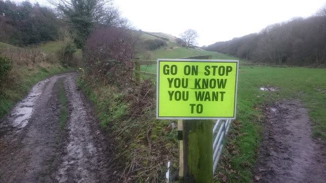
My fourth time running this one. It's called a marathon, but the distance on this one is over 30m. The Hardmoors events tend to have some motivational signs and the distance today was highlighted in this photo by John Freel of one of the signs


I was running with Sara today and we had a great run. Sadly, the other third of our running team, Kath, couldn't make this one. Melanie was doing the half marathon today and unlike last year, I didn't see her out on the course this time.

I was up before 5.00 to get to Guisborough. We started a little late, 8.10, but it was daylight by then and I took a photo of Guisborough as we started to climb up to the hills.


The climb up to High Cliff Nab wasn't too muddy, but it did get more slippy the higher we went. We chatted to other runners as we passed them and they passed us, it was a very social race today. Then after a few miles we came to Roseberry Topping, which looked awesome.


We went up and then down the other side right to the bottom, turned round and went back up the same way and then down another side. At the second time, the marshall kindly took this photo of us


As we came back up to the top of Little Roseberry we were snapped by one of the SportsSunday team


Then it was along to Gribdale and up to the James Cook Monument. There is normally a decorated tree on the way up, but this year there were two, which was great.


Just before the monument there was another SportsSunday photographer with Roseberry Topping in the background.


Soon after the monument the half marathon runners turned for home and we plunged down a road to Kildale and dragged our way up again and on almost as far as Blowarth Crossing before turning off the Cleveland Way and heading towards Castleton.

The route over the Westerdale Moor I love. It is part of the Esk Valley path that Melanie and I ran in sections eighteen months ago. Here is a view down into the valley


Onwards to Castleton station and the steep climb up to where David Toth was waiting at his checkpoint with drinks, food and his motivational sign.


Then it was along the undulating track to Commondale where I had an incident on the first running of this event. No problems this year, we didn't stop and climbed the hill to the final checkpoint at about 25m. In theory that should have been 1.2m to go, but it was another 5m across the moors as the sky darkened. We just about made it to Guisborough Woods without having to put on head torches, but it was getting very dark so we put them on for the muddy descent back to the finish.

We got into the hall and received our pink tee shirt and pink medal 


and then much to my surprise I was awarded the v60 prize again - my sixth at Hardmoors ! Thanks to Phil for this photo


A fantastic day out 😀


Sunday, 13 November 2016

Hardmoors Goathland marathon 2016

I have done this event the last two years and the weather has been pretty bad. In 2014 it rained heavily in the second half. Here is a photo of Melanie and I approaching the finish


In 2015 it went the other way and it was heavy rain in the first half, but turned out to be a lovely second half. Here is Diane and I approaching Saltergate (this year's Saltergate photo is further down)


The forecast on the Thursday before this year's event was (click to see the detail)


So it looked like it was going to be very, very wet and windy. However, the forecast kept on improving, but it still had heavy rain and drizzle for the time I would be out there. As I parked the car in Goathland and walked over to the Village Hall there was a bit of rain, but not heavy. However, the wind was quite strong so I had waterproof top and bottoms on to keep warm.

The Village Hall was lovely and warm and I chatted to Garth and other people I knew. At the race briefing Jon threw in that there was going to be four and half hour cut off at Saltergate at 15m. So that was my target, get there in that time and I should be fine to finish in the overall cut off of 9hr. I didn't think I would take anywhere near that long as I had finished in a bit over 7hr last year, but you can never be certain that you won't injure yourself and have to slow down.

Outside at the start, the rain had now become light drizzle and the wind had dropped a little. I decided to keep on the full waterproofs as I felt that once on the moors the waterproofs would help keep me warm and that worked out well.

The route was advertised to be the same as it had been for the last two years, so I had no anxieties about finding my way. To be sure, I had the route on my watch and maps downloaded to my phone.

I stayed at the back at the start


as I wanted to take my time over the rocks at Mallyan Spout 


and not feel any pressure to go too fast. At this point the drizzle had stopped so my hat came off and remained off for the rest of the race. I kept the thin gloves on though.

After this there was a long pull up onto the moors


The visibility was quite good at this point. After the first checkpoint, we climbed up to Simon Howe and the mist got thicker. On the way up, with Jason, Paul and Dee, some other runners were coming across at 90 degrees towards us, quite how they had gone wrong I couldn't figure out. By Simon Howe I had left the others and started south towards Wardle Rigg.

The mist here was quite thick and at one point I had to think exactly where I was. With no landmarks in sight it felt disorientating and for a short while I thought I was going west from Simon Howe. I quickly pulled myself together and remembered I was going south, checked my watch for the route and carried on. 

Approaching the Wardle Rigg checkpoint we came across the very waterlogged section of the course. There was no alternative but to wade through some of it. I always wear waterproof socks for this event and they worked just as well as they have done before.

The descent to the railway line and the pull up to just below Saltergate were fine. The colours in the woods in the valley were lovely


In the previous two events this has always been a low point as I know that the Saltergate checkpoint is only half a mile away, 


but we have to go all the way 


along to Levisham Bottoms, climb up to another checkpoint outside Levisham and do a drag up Levisham Moor to reach the Saltergate checkpoint (probably about 5m in distance).

This year I didn't feel this low point, I just got on with it. The run along Levisham Bottoms was lovely, you could look across the misty valley.


As I climbed up to Checkpoint 4, near Levisham, we entered thick cloud with visibility down to about 50 meters. I got to where Checkpoint 4 was supposed to be and there were just two people standing there. I asked whether they wanted my number and they said no they were just spectators. This threw me a little and then Jon, the race director, appeared out of the mist and said I needed to go down to Dundale pond, up the hill to where the checkpoint was because the checkpoint wasn't in the right place.

This didn't make any sense to me, how did they get the checkpoint to be on the way to Saltergate, I couldn't remember any road access on that section. Oh well, off I went down to the pond where there was marshall who took my number and then said I needed to go back up another hill but not north to Saltergate, but in a roughly southerly direction back to Levisham but up another track which leads to a road end and that was where the checkpoint was. The marshall said I would then be coming back to him, so I imagined we were doing an out and back section to fit the checkpoint in. It wasn't quite like that, we did the other two sides of a triangle (you can see the triangle on the second map above) to come back to the marshall at the pond. As I came back back Jon shouted out that he had managed to lengthen the route and add more ascent ! I asked the marshall at the Pond whether this had confused the lead runners and apparently it had. I guess if you don't find a checkpoint you just carry on along the route, you don't go looking for it.

At this point I could see two other runners gently jogging up the hill and disappearing into the mist. I decided just to walk this gentle ascent, I felt tired and there was still a long way to go. I knew that I would make the four and half hour cut off at Saltergate which would probably be extended anyway because of the Checkpoint 4 confusion. It is a shame there were no views from here as the mist was so thick.

I made it to Saltergate in four hours. The road was busy there and visibility was probably less than 50 meters but the crossing was well marshalled. Thanks to Matthew Nelson for these two photos


I caught up with the other two runners who were just ahead of me, but again they started running as I continued walking up any ascent I came across. Again I caught them at the turn off the Old Wife's Way and again they ran on into the mist.

I came up to Malo Cross


which looked in danger of falling over. Then over the boggy section to Fylingdales and on to hard track. Again I nearly caught up with the two runners who looked unsure of the way, but once they saw me approaching they felt reassured and ran on into the mist and out of sight.

Again they were only just ahead of me at Lilla Cross. Rod, the marshall there, warned me that the beck at the bottom which we had to cross was in full spate, so I knew that would be fun. I went down the muddy path from the cross carefully and my two front runners vanished again into the mist. After the muddy path end the route goes along a well surface track before turning off onto the moor. The turn was well taped, but it came up suddenly (there is no permanent sign or I didn't see it) and I wasn't expecting it to be quite where it was. I trudged down this very boggy section crossing multiple small streams. This was part of the Lyke Wake route that I had done in July (but in the other direction). It was wet then, but it it was much worse yesterday. 

Jon had taped the crossing of the beck, but it looked like you had to wade so I ignored that and went to where I normally cross (I heard later that people who crossed there had water way above their knees) and got across without getting wet.

Down and out of the mist and I couldn't see my two front runners anywhere. I thought they had either made very good progress on this boggy section or possibly they had missed the turn on the moor (it turned out to be the latter as they finished after me).

Now the clouds had lifted, it was turning into a lovely evening. I got to the last checkpoint at Ellerbeck where I was directed across the road and not over the bridge, so I was jumping across the stream again ! Then down into the valley and across the railway line again and up to Simon Howe where the two marshalls were in good spirits despite being out on a hill top all day. Photo taken by Mark Dalton


Then it was the lovely descent back to Goathland and the Village Hall. Back in 7hr 3min which was better than in 2015, but not as good as 2014 when I ran it with Melanie.

A hard but a lovely day out on an attractive route. 

Part of me wished that the route had included the stepping stones at Wheeldale which were on the half marathon route. The stepping stones looked like this on the Lyke Wake


Here are a couple of pictures from yesterday (photos by Valerie Kidd)